Redcar and Cleveland
Redcar and Cleveland/R/2024/0722/CD
of existing highway bin; g) Relocation of existing knee rail; h) Highway drainage plan. Including the removal and/or relocation of existing highway drainage to facilitate the new vehicular access; and i) Full width carriageway surfacing of Westfield Way adjacent to the new access. Reason: In the interests of providing a safe means of access to the site by all modes of transport and to, minimise disruptions to the free flow of traffic having regard for local plan policy and sections 9 and 12 of the NPPF. 6 The development hereby approved shall not be brought into use until covered and secure cycle parking facilities, for 24 cycles, have been provided in accordance with drawings to be submitted to and approved in writing by the Local Planning Authority. Such drawings to show the position, design, materials and finishes thereof. Thereafter the cycle parking facilities shall be retained in perpetuity for the sole purpose of parking cycles. Reason: To promote use of cycles reducing traffic congestion and in the interests of the amenities of residents to ensure a satisfactory form of development having regard for local plan policy and sections 9 and 12 of the NPPF. If you are unable to find the
- Reference
- Redcar and Cleveland/R/2024/0722/CD
- Authority
- Redcar and Cleveland
- Application type
- Condition Discharge
- Address
- of existing highway bin; g) Relocation of existing knee rail; h) Highway drainage plan. Including the removal and/or relocation of existing highway drainage to facilitate the new vehicular access; and i) Full width carriageway surfacing of Westfield Way adjacent to the new access. Reason: In the interests of providing a safe means of access to the site by all modes of transport and to, minimise disruptions to the free flow of traffic having regard for local plan policy and sections 9 and 12 of the NPPF. 6 The development hereby approved shall not be brought into use until covered and secure cycle parking facilities, for 24 cycles, have been provided in accordance with drawings to be submitted to and approved in writing by the Local Planning Authority. Such drawings to show the position, design, materials and finishes thereof. Thereafter the cycle parking facilities shall be retained in perpetuity for the sole purpose of parking cycles. Reason: To promote use of cycles reducing traffic congestion and in the interests of the amenities of residents to ensure a satisfactory form of development having regard for local plan policy and sections 9 and 12 of the NPPF. If you are unable to find the
- Status
- Approved Parish(es) Loftus CP
- Decision
- CONDITION DISCHARGE GRANTED
- Received
- 30 Oct 2024
- Started
- 30 Oct 2024
- Decided
- 5 Mar 2025
- Source council
- Redcar and Cleveland
- Council source record
- View public record
- Public data licence
- Open Government Licence v3.0
- Record updated
- 6 Aug 2026
- SEO index generated
- 7 Aug 2026
Location
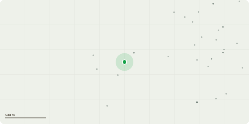
Approximate location
Proposal
of the preferred option(s). This must be conducted in accordance with Environment Agency’s Land Contamination Risk Management Guidance (b) Submission of Remediation Scheme A detailed remediation scheme to bring the site to a condition suitable for the intended use by removing unacceptable risks to human health, buildings and other property and the natural and historical environment must be prepared, and is subject to the approval in writing of the Local Planning Authority. The scheme must include all works to be undertaken, proposed remediation objectives and remediation criteria, timetable of works and site management procedures. The scheme must ensure that the site will not qualify as contaminated land under Part 2A of the Environmental Protection Act 1990 in relation to the intended use of the land after remediation. (c) Implementation of Approved Remediation Scheme The approved remediation scheme must be carried out in accordance with its terms prior to the commencement of development other than that required to carry out remediation, unless otherwise agreed in writing by the Local Planning Authority. The Local Planning Authority must be given two weeks written notification of commencement of the remediation scheme works. Following completion of measures identified in the approved remediation scheme, a verification report that demonstrates the effectiveness of the remediation carried out must be produced, and is subject to the approval in writing of the Local Planning Authority. (d) Reporting of Unexpected Contamination In the event that contamination is found at any time when carrying out the approved development that was not previously identified it must be reported in writing immediately to the Local Planning Authority. An investigation and risk assessment must be undertaken in accordance with the requirements of part (a) and where remediation is necessary a remediation scheme must be prepared in accordance with the requirements of part (b), which is subject to the approval in writing of the Local Planning Authority. Following completion of measures identified in the approved remediation scheme a verification report must be prepared, which is subject to the approval in writing of the Local Planning Authority. (e) Long Term Monitoring and Maintenance A monitoring and maintenance scheme to include monitoring the long-term effectiveness of the proposed remediation over a period of 10 years, and the provision of reports on the same must be prepared, both of which are subject to the approval in writing of the Local Planning Authority. Following completion of the measures identified in that scheme and when the remediation objectives have been achieved, reports that demonstrate the effectiveness of the monitoring and maintenance carried out must be produced, and submitted to the Local Planning Authority. This must be conducted in accordance with Environment Agency’s Land Contamination Risk Management Guidance REASON : To ensure that risks from land contamination to the future users of the land and neighbouring land are minimised, together with those to controlled waters, property and ecological systems, and to ensure that the development can be carried out safely without unacceptable risks to workers, neighbours and other offsite receptors. REASON FOR PRE-COMMENCEMENT: The information is required prior to any works commencing on site it relates to land contamination details which are often the first works on site and relate to site preparation. 3 Use of the development shall not commence until a community use agreement prepared in consultation with Sport England has been submitted to and approved in writing by the Local Planning Authority, and a copy of the completed approved agreement has been provided to the Local Planning Authority. The agreement shall apply to artificial grass pitch (and supporting facilities)and include details of pricing policy, hours of use, access by non-Middlesbrough FC Foundation teams, management responsibilities and a mechanism for review. The development shall not be used otherwise than in strict compliance with the approved agreement." Reason: To secure well managed safe community access to the sports facility/facilities, to ensure sufficient benefit to the development of sport and to accord with Development Plan Policy. Informative: Guidance on preparing Community Use Agreements is available from Sport England. http://www.sportengland.org/planningapplications/ For artificial grass pitches it is recommended that you seek guidance from the Football Association on pitch construction when determining the community use hours the artificial pitch can accommodate. 4 The development shall not be occupied until a Management & Maintenance Plan for the surface water drainage scheme has been submitted to and approved by the Local planning Authority; the plan shall include details of the following; (i) A plan clearly identifying the sections of surface water system that are to be adopted (ii) Arrangements for the short and long term maintenance of the SuDS elements of the surface water system REASON: To ensure that the surface water drainage infrastructure is maintained to minimise the risk flooding in the locality. 5 The development hereby permied shall not come into use until the highway works detailed below have been carried out in accordance with plans which are subsequently submitted to and approved in wring by the Local Planning Authority: a) The creation of a vehicular access onto Westfield Way only; b) The creation of a footway/footpath link that connects to existing highway infrastructure on Westfield Way; c) Installation of highway lighting on Westfield Way to ensure the proposed access is illuminated; d) Removal of the vehicular access on to Hummersea Lane (Seymour Hill Terrace). Including the introduction of a kerbline, footway, layby and bollards as required; e) Renewal of the point closure on Westfield Way. Including footway surfacing, kerb line renewal and bollards to ensure vehicular access is restricted; f) Relocation of existing highway bin; g) Relocation of existing knee rail; h) Highway drainage plan. Including the removal and/or relocation of existing highway drainage to facilitate the new vehicular access; and i) Full width carriageway surfacing of Westfield Way adjacent to the new access. Reason: In the interests of providing a safe means of access to the site by all modes of transport and to, minimise disruptions to the free flow of traffic having regard for local plan policy and sections 9 and 12 of the NPPF. 6 The development hereby approved shall not be brought into use until covered and secure cycle parking facilities, for 24 cycles, have been provided in accordance with drawings to be submitted to and approved in writing by the Local Planning Authority. Such drawings to show the position, design, materials and finishes thereof. Thereafter the cycle parking facilities shall be retained in perpetuity for the sole purpose of parking cycles. Reason: To promote use of cycles reducing traffic congestion and in the interests of the amenities of residents to ensure a satisfactory form of development having regard for local plan policy and sections 9 and 12 of the NPPF. If you are unable to find the
Key dates
- Received 30 Oct 2024
- Started 30 Oct 2024
- Decided 5 Mar 2025
Planning history / related applications
No related planning applications have been identified in the current public OGL dataset.
Inside plotEdge
Go beyond the public record
This page is the public OGL record. plotEdge adds the private intelligence layer for this site - open it in the app to unlock:
- Ownership & title Registered owner and title from HM Land Registry.
- Viability & build potential Site scoring and development upside.
- Constraints Flood risk, green belt, conservation areas and designations.
- Approval signal Planning risk and approval-likelihood analysis.
- Comparable applications Decisions on similar nearby sites, side by side.
- Status alerts Get notified the moment this application changes.
Source: public planning application data from Redcar and Cleveland, reused under the Open Government Licence v3.0. View the council source record. Council documents and drawings are not republished on plotEdge.