Wandsworth
Wandsworth/2026/2500
100 York Road 110 York Road and Car Park to Rear
- Reference
- Wandsworth/2026/2500
- Authority
- Wandsworth
- Application type
- Matters relating to a S106 Agreement
- Address
- 100 York Road 110 York Road and Car Park to Rear
- Status
- REGISTERED
- Received
- 20 Jul 2026
- Started
- 20 Jul 2026
- Source council
- Wandsworth
- Council source record
- View public record
- Public data licence
- Open Government Licence v3.0
- Record updated
- 21 Jul 2026
- SEO index generated
- 24 Jul 2026
Location
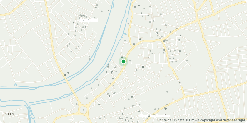
Approximate location - Contains OS data © Crown copyright and database right
Proposal
Matters relating to S106 Agreement (Schedule 4 Part 2 Paragraph 1 - Residential Travel Plan; Schedule 4 Part 2 Paragraph 6 - Workplace Travel Plan; Schedule 4 Part 5 - Car Parking Management Plan; Schedule 8 Paragraphs 1-4 - Delivery and Services Management Plan) in respect of the agreement dated 5 December 2019 in relation to planning permission 2017/0745 (Erection of a 25 storey building comprising 136 flats (with balconies) and ground floor retail floorspace (Class A1). Demolition of car showroom on Bridges Court and erection of a five storey building to provide ground floor retail (Class A1) floorspace and office floorspace (Class B1) on first to fourth floors. Excavation to create basements comprising 85 car parking and 344 cycle parking spaces, gym, plant and refuse/recycling stores. Alterations and erection of two additional storeys (and 2nd/3rd floor links) and roof terrace to retained York Road buildings with retail (Class A1) and office use (Class B1). Provision of a terrace of six single storey retail use units (Class A1/A2/A3/A4). Provision of amenity space, public realm, landscaping, play space, car parking, and paving to Bridges Court.).
Key dates
- Received 20 Jul 2026
- Started 20 Jul 2026
Planning history / related applications
No related planning applications have been identified in the current public OGL dataset.
Inside plotEdge
Go beyond the public record
This page is the public OGL record. plotEdge adds the private intelligence layer for this site - open it in the app to unlock:
- Ownership & title Registered owner and title from HM Land Registry.
- Viability & build potential Site scoring and development upside.
- Constraints Flood risk, green belt, conservation areas and designations.
- Approval signal Planning risk and approval-likelihood analysis.
- Comparable applications Decisions on similar nearby sites, side by side.
- Status alerts Get notified the moment this application changes.
Source: public planning application data from Wandsworth, reused under the Open Government Licence v3.0. View the council source record. Council documents and drawings are not republished on plotEdge.