Wandsworth
Wandsworth/2026/1275
The Roehampton Priory Hospital, Roehampton Hospital School Priory Lane SW15 5JJ
- Reference
- Wandsworth/2026/1275
- Authority
- Wandsworth
- Application type
- Works to a T.P.O. Tree
- Address
- The Roehampton Priory Hospital, Roehampton Hospital School Priory Lane SW15 5JJ
- Postcode
- SW15 5JJ
- Status
- NEW
- Received
- 1 Apr 2026
- Started
- 1 Apr 2026
- Source council
- Wandsworth
- Council source record
- View public record
- Public data licence
- Open Government Licence v3.0
- Record updated
- 12 Jul 2026
- SEO index generated
- 24 Jul 2026
Location
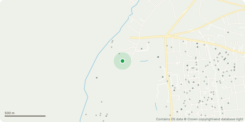
Approximate location - Contains OS data © Crown copyright and database right
Proposal
G001 - "Elder x15 (Sambucus nigra)" - Crownlift to 4m TOO1 - "Lime (Tilia sp.)" - Monolith at 3m T004 - "Holly (Ilex sp.)" - Fell tree and grind stump T005 - "Holly (Ilex sp.)" - Remove deadwood stub and reduce top by 3m T007 - "Holly(Ilex sp.)" - Remove both stems and grind stump T008 - "London plane (Platanus x hispanica)" - Crown lift lower branches 1.5 - 2m clear of tennis court netting T010 - "Lime (Tilia sp.)" - Remove deadwood and hanging branches, Crown raise over wall to provide 1.5-2m clearance T011 - "Hornbeam (Carpinus betulus)" - Remove deadwood, remove lower eppicormic growth that's touching listed wall. T012 - "Elm (Ulmus sp.)" - Remove fallen trees and fell remaining tree T013 - "Field maple (Acer campestre)" - Prune lower branchs away from play equipment 1.5 - 2m T014 - "Lime (Tilia sp.)" - Remove deadwood over playground and prune lower limbs away from fence and play equipment 1-2m T015 - "Lime (Tilia sp.)" - Remove deadwood over playground T016 - "Lime (Tilia sp.)" - Remove deadwood over playground area T017 - "Lime (Tilia sp.)" - Remove deadwood over playground T018 - "Lime (Tilia sp.)" - Reduce by 2-3m, remove deadwood and crownlift to 4m T019 - "Lime (Tilia sp.)" - Remove deadwood, lift over road 4m
Key dates
- Received 1 Apr 2026
- Started 1 Apr 2026
Planning history / related applications
No related planning applications have been identified in the current public OGL dataset.
Inside plotEdge
Go beyond the public record
This page is the public OGL record. plotEdge adds the private intelligence layer for this site - open it in the app to unlock:
- Ownership & title Registered owner and title from HM Land Registry.
- Viability & build potential Site scoring and development upside.
- Constraints Flood risk, green belt, conservation areas and designations.
- Approval signal Planning risk and approval-likelihood analysis.
- Comparable applications Decisions on similar nearby sites, side by side.
- Status alerts Get notified the moment this application changes.
Source: public planning application data from Wandsworth, reused under the Open Government Licence v3.0. View the council source record. Council documents and drawings are not republished on plotEdge.