Wandsworth
Wandsworth/2024/3038
Roehampton Playing Field Dover House Road SW15 5FG
- Reference
- Wandsworth/2024/3038
- Authority
- Wandsworth
- Application type
- Work to trees in conservation area
- Address
- Roehampton Playing Field Dover House Road SW15 5FG
- Postcode
- SW15 5FG
- Status
- WITHDRAWN
- Decision
- Withdrawn
- Received
- 7 Oct 2024
- Started
- 7 Oct 2024
- Source council
- Wandsworth
- Council source record
- View public record
- Public data licence
- Open Government Licence v3.0
- Record updated
- 13 Jul 2026
- SEO index generated
- 24 Jul 2026
Location
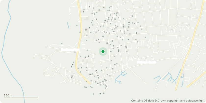
Approximate location - Contains OS data © Crown copyright and database right
Proposal
Please see accompanying Site Plan for location of the tree, this being positioned immediately behind and overhanging 30 Gillis Square SW15 5FG (within the Queen Mary's Place development), thus creating significant shading and gutter/drainage issues as well as significant debris fall into the garden. We wish to reduce back to the common boundary all overhanging branches. However, this is likely to leave the canopy lacking balance, meaning if acceptable, we propose to undertake a balanced Crown Reduction by a Council approved contractor, reducing the height and girth of the tree by no more than 2.5m. We also hope to meet with an Officer from the Council to discuss this, but the Holly hedge has received no maintenance since QMP was completed approximately 13 years ago. It is accordingly now extremely dense and overgrown, and in places up to 20 metres in height, thus threatening the wellbeing of the trees growing within it including the Acacia located immediately behind 30 Gillis Square. It follows it is likely these trees are being driven to grow ever higher in order to escape the fast-growing, encroaching Holly.
Key dates
- Received 7 Oct 2024
- Started 7 Oct 2024
Planning history / related applications
No related planning applications have been identified in the current public OGL dataset.
Inside plotEdge
Go beyond the public record
This page is the public OGL record. plotEdge adds the private intelligence layer for this site - open it in the app to unlock:
- Ownership & title Registered owner and title from HM Land Registry.
- Viability & build potential Site scoring and development upside.
- Constraints Flood risk, green belt, conservation areas and designations.
- Approval signal Planning risk and approval-likelihood analysis.
- Comparable applications Decisions on similar nearby sites, side by side.
- Status alerts Get notified the moment this application changes.
Source: public planning application data from Wandsworth, reused under the Open Government Licence v3.0. View the council source record. Council documents and drawings are not republished on plotEdge.