North Yorkshire
North Yorkshire/25/02676/SCREEN
Land Comprising OS Field 3300 Marton Le Moor YO51 9DP Alternatively Referred To As Land Adjacent To The A1(M) Between Junctions 48 And 49 Near Kirby Hill Harrogate YO51 9DP
- Reference
- North Yorkshire/25/02676/SCREEN
- Authority
- North Yorkshire
- Application type
- SCREEN
- Address
- Land Comprising OS Field 3300 Marton Le Moor YO51 9DP Alternatively Referred To As Land Adjacent To The A1(M) Between Junctions 48 And 49 Near Kirby Hill Harrogate YO51 9DP
- Postcode
- YO51 9DP
- Status
- Decided
- Decision
- Env Impact Assessment Not Required
- Received
- 22 Apr 2025
- Validated
- 22 Apr 2025
- Started
- 22 Apr 2025
- Decided
- 1 Oct 2025
- Source council
- North Yorkshire
- Council source record
- View public record
- Public data licence
- Open Government Licence v3.0
- Record updated
- 2 Jul 2026
- SEO index generated
- 24 Jul 2026
Location
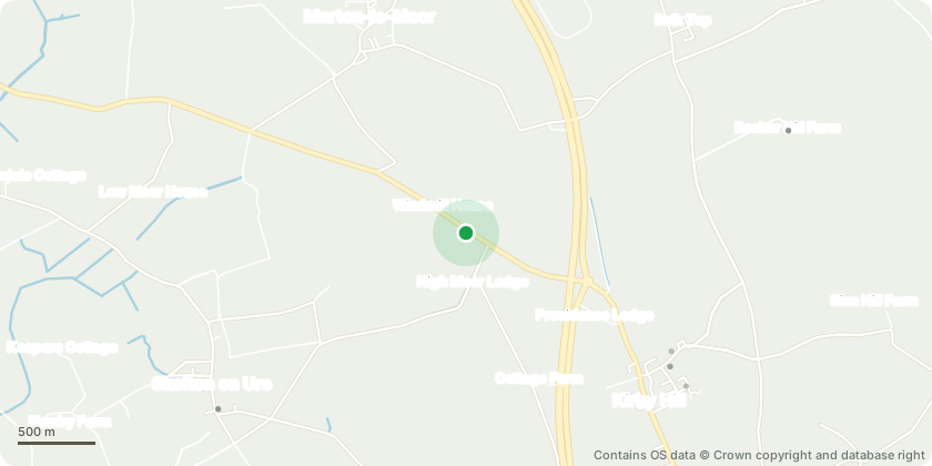
Approximate location - Contains OS data © Crown copyright and database right
Proposal
Screening opinion for the reserved matters of access, appearance, landscaping, layout and scale of a Motorway Service Area to the west side of the A1(M) with vehicular over bridge to and from southbound carriageway and partial diversion of the A168, including associated infrastructure and staff access from B6265 as detailed under application ZC23/04592/REMMAJ (as allowed in outline under planning appeal APP/E2734/W/20/3245778 and accompanied by an Environmental Statement, and varied, also accompanied by an Environmental Statement, in terms of slip road lengths, permissible height of the eastern dumbbell roundabout and minor amendments to the indicative design of associated infrastructure and landscape works by Section 73 permission ZC23/01168/DVCMAJ).
Key dates
- Received 22 Apr 2025
- Validated 22 Apr 2025
- Started 22 Apr 2025
- Decided 1 Oct 2025
Planning history / related applications
No related planning applications have been identified in the current public OGL dataset.
Inside plotEdge
Go beyond the public record
This page is the public OGL record. plotEdge adds the private intelligence layer for this site - open it in the app to unlock:
- Ownership & title Registered owner and title from HM Land Registry.
- Viability & build potential Site scoring and development upside.
- Constraints Flood risk, green belt, conservation areas and designations.
- Approval signal Planning risk and approval-likelihood analysis.
- Comparable applications Decisions on similar nearby sites, side by side.
- Status alerts Get notified the moment this application changes.
Source: public planning application data from North Yorkshire, reused under the Open Government Licence v3.0. View the council source record. Council documents and drawings are not republished on plotEdge.