Lewisham
Lewisham/DC/24/137988
34 SYDENHAM HILL, LONDON, SE26 6LS
- Reference
- Lewisham/DC/24/137988
- Authority
- Lewisham
- Address
- 34 SYDENHAM HILL, LONDON, SE26 6LS
- Postcode
- SE26 6LS
- Status
- Unknown
- Decision
- Raise No Objection
- Received
- 1 Nov 2024
- Validated
- 8 Nov 2024
- Started
- 8 Nov 2024
- Decided
- 27 Aug 2025
- Source council
- Lewisham
- Council source record
- View public record
- Public data licence
- Open Government Licence v3.0
- Record updated
- 18 Jul 2026
- SEO index generated
- 24 Jul 2026
Location
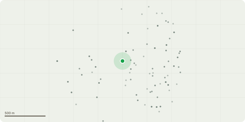
Approximate location
Proposal
FRONT: ONE Ash (T8) LATERAL REDUCE overhanging branches back to boundary by 2m from 4m to 2m on West compass removing deadwood. REASON: Overhanging main road.REAR SIDE (LHB): ONE Blue Atlas Cedar (T15)(ht.15m,spread 15m) LATERAL REDUCE by removal of lowest limb. REASON: Extending towards building.REAR SIDE (LHB): TWO Deodar Cedar (T16,T17)(ht.12m,spread 10m) CROWN LIFT to 4m. REAR: ONE Deodar Cedar (T23)(ht.18m,spread 12m) CROWN LIFT secondary branches to 3m. REASON: Provide clearance from neighbouring roof.REAR SIDE (LHB): ONE Lawson Cypress (T24)(ht.8m,spread 6m) CROWN LIFT to 4m. REASON: Provide clearance from ground level.REAR: ONE Lawson Cypress (T25)(ht.12m,spread 6m) CROWN LIFT to 4m. REAR: ONE Bay tree (T27)(ht.12m,spread 6m) CROWN LIFT to 3m. REASON: Clearance from neighbouring roof.REAR: ONE Cypress (T31)(ht.8m,spread 4m) CROWN LIFT to 3m. REASON: Clearance from ground level.REAR: ONE Deodar Cedar (T32)(ht.20m,spread 10m) LATERAL REDUCE one large limb by 3m from 6m to 3m.REAR CENTRAL: ONE Deodar Cedar (T38)(ht.10m) FELL. (retain encouraged - shown retained in Soft Landscape Plan, shown retained in Coach House Landscaping Plan DC/24/136122, shown fell in TPP DC/24/137138). REAR SIDE (RHB): TWO: 1xHornbeam & 1xSycamore (T44, T45)(ht.12m,spread 6m) CROWN LIFT to 4m. REASON: Provide clearance from ground level.REAR CENTRAL: TWO Sycamore (T46,T47)(ht.15m) FELL. (shown removed in Soft Landscape Plan, shown fell in Coach House Landscape Plan DC/24/136122, shown fell in TPP DC/24/137138)REAR CENTRAL: ONE Yew (T48)(ht.8m) FELL. (retain encouraged - shown removed in Soft Landscape Plan, shown retained in Coach House Landscaping Plan DC/24/136122, shown fell in TPP DC/24/137138)REAR CENTRAL: ONE Sycamore (T50)(ht.10m) FELL. (shown removed in Soft Landscape Plan, shown fell in Coach House Landscaping Plan DC/24/136122, shown fell in TPP DC/24/137138)REASON: Development of site planning consent DC/20/118980 (ref. DC/24/136122 ? c.7a Landscape Plans, c.8 Tree Replacement, c.18 Bat and Bird Boxes/Wildlife, and DC/24/137138 ? c.5 Tree Protection Plan).Informative A: as disparity between approved development plans, encourage retention of Cedar (T38) and Yew (T48) - Council to contact the site developer that if Cedar (T38) & Yew (T48) are felled to submit amended plans with replacement tree planting and bird box for: Soft Landscape Plan 359/01C, Coach House Landscaping Plan, Cedars and the Coach House Bat/Bird Boxes Plan (DC/24/136122 conditions 7a, 8, 18).Informative B: several off-site trees (T35-T37,T40-T42) on the L&Q Sydenham Hill Estate have been removed to enable foundations for the Coach House, ref tree officer tel call 7.3.25 with site manager/team leader for TreesUk. Council to contact the site developer to submit amended plans with replacement tree planting as these trees are shown retained in Soft Landscape Plan 359/01C, shown retained in Coach House Landscaping Plan (DC/24/136122 conditions 7a, 8), shown retained in the Tree Protection Plan Rev B (TPP) (DC/24/137138 condition 5).Informative C: see linked 6-week notice case: DC/24/138804. Informative D: creation of habitat log piles encouraged on site with arisings for wildlife and biodiversity.
Key dates
- Received 1 Nov 2024
- Validated 8 Nov 2024
- Started 8 Nov 2024
- Decided 27 Aug 2025
Planning history / related applications
No related planning applications have been identified in the current public OGL dataset.
Inside plotEdge
Go beyond the public record
This page is the public OGL record. plotEdge adds the private intelligence layer for this site - open it in the app to unlock:
- Ownership & title Registered owner and title from HM Land Registry.
- Viability & build potential Site scoring and development upside.
- Constraints Flood risk, green belt, conservation areas and designations.
- Approval signal Planning risk and approval-likelihood analysis.
- Comparable applications Decisions on similar nearby sites, side by side.
- Status alerts Get notified the moment this application changes.
Source: public planning application data from Lewisham, reused under the Open Government Licence v3.0. View the council source record. Council documents and drawings are not republished on plotEdge.