Lewisham
Lewisham/DC/24/137912
LAND AT THE REAR OF, 47-83 DUNCOMBE HILL, LONDON, SE23 1QY
- Reference
- Lewisham/DC/24/137912
- Authority
- Lewisham
- Address
- LAND AT THE REAR OF, 47-83 DUNCOMBE HILL, LONDON, SE23 1QY
- Postcode
- SE23 1QY
- Status
- Unknown
- Decision
- Granted
- Received
- 24 Oct 2024
- Validated
- 11 Nov 2024
- Started
- 11 Nov 2024
- Decided
- 5 Dec 2024
- Source council
- Lewisham
- Council source record
- View public record
- Public data licence
- Open Government Licence v3.0
- Record updated
- 18 Jul 2026
- SEO index generated
- 24 Jul 2026
Location
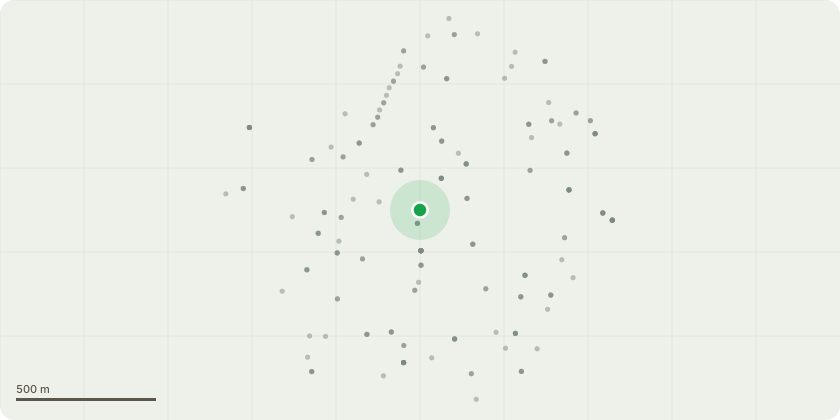
Approximate location
Proposal
ONE Ash (T1 in TPO)(ht.12m) CROWN REDUCE HEIGHT by 2m from 12m to 10m, REDUCE LATERAL SPREAD by 2m from 9m to 7m. Reason: Reduction to shape canopy, pruning to suitable points and maintaining natural aesthetic. ONE dead Cherry (T2 in TPO)(ht.8m) MONOLITH to 4m for habitat. Reason: Monolith Tree of approximately 8m in height. The tree has died, reduce to leave monolith at ht.4m for habitat. Replanting proposed with a Prunus cerasifera. ONE Cherry (T3 in TPO)(ht.10m) CROWN REDUCE HEIGHT by 2m from 10m to 8m, REDUCE LATERAL SPREAD by 2m from 9m to 7m. Reason: signs of decay in the lower stem, reduce canopy weight, pruning to suitable points to maintain natural aesthetic. ONE Horse chestnut (T4 in TPO) CROWN REDUCE HEIGHT by 3m from 14m to 11m, REDUCE LATERAL SPREAD by 2m from 12m to 10m. Reason: signs of decay in the upper stem, reduction to shape canopy, pruning to suitable points and maintaining natural aesthetic. ONE Cherry (T5 in TPO)(ht.10m) remove dead stem by 4m from 4m to 0m. Reason: one stem has died and should be removed to reduce likelihood of failure (exempt works). ONE Lime (T6 in TPO)(ht.16m) REDUCE LATERAL SPREAD by 3m from 10m to 7m. Reason: Reduction to shape canopy, pruning to suitable points and maintaining natural aesthetic. Height to remain the same. ONE Lime (T7 in TPO)(ht.14m) CROWN REDUCE HEIGHT by 3m from 14m to 11m, REDUCE LATERAL SPREAD by 2m from 12m to 10m. Reason: large cavity in the upper stem, pruning to suitable points to maintain natural aesthetic. ONE Lime (T8 in TPO)(ht.13m) CROWN REDUCE HEIGHT by 3m from 13m to 10m, REDUCE LATERAL SPREAD by 3m from 10m to 7m. Reason: large cavity in the upper stem, pruning to suitable points to maintain natural aesthetic. ONE Horse chestnut (T9 in TPO)(ht.16m) REDUCE LATERAL SPREAD by 3m from 10m to 7m, CROWN LIFT to 4m above ground level. Reason: works to shape canopy, pruning to suitable points to maintain natural aesthetic, height to remain the same. ONE Sorbus (T10 in TPO)(ht.6m) FELL. Reason: large cavity in base of leaning stem compromises the integrity of the tree, H & S reasons. Replace with native tree. ONE Hawthorn (T11 in TPO)(ht.10m) CROWN REDUCE HEIGHT by 2m from 10m to 8m, REDUCE LATERAL SPREAD by 2m from 9m to 7m. Reason: signs of decay in the lower stem, reduce canopy weight, pruning to suitable points to maintain natural aesthetic. The London Borough of Lewisham (Brockley Hill) Tree Preservation Order 1973 ? TPO Group (T43)Informative A: cherry (T2), dead ? for the proposed replacement with a Prunus cerasifera see replanting details below; Informative B: Sorbus (T10), leaning fell - for the proposed replacement with a native species select from whitebeam (Sorbus aria), wild service tree (Sorbus torminalis) or Whitty Pear (Sorbus domestica), and see replanting details below; Informative C: the continued sensitive management of the TPO trees to maintain the tree canopy and woodland character of the Private Gardens with areas of understorey, ground cover and deadwood retained on site is greatly appreciated for amenity, wildlife, environmental benefits and climate change mitigation.
Key dates
- Received 24 Oct 2024
- Validated 11 Nov 2024
- Started 11 Nov 2024
- Decided 5 Dec 2024
Planning history / related applications
No related planning applications have been identified in the current public OGL dataset.
Inside plotEdge
Go beyond the public record
This page is the public OGL record. plotEdge adds the private intelligence layer for this site - open it in the app to unlock:
- Ownership & title Registered owner and title from HM Land Registry.
- Viability & build potential Site scoring and development upside.
- Constraints Flood risk, green belt, conservation areas and designations.
- Approval signal Planning risk and approval-likelihood analysis.
- Comparable applications Decisions on similar nearby sites, side by side.
- Status alerts Get notified the moment this application changes.
Source: public planning application data from Lewisham, reused under the Open Government Licence v3.0. View the council source record. Council documents and drawings are not republished on plotEdge.