Lambeth
Lambeth/25/01445/TPO
395 Clapham Road London SW9 9BT
- Reference
- Lambeth/25/01445/TPO
- Authority
- Lambeth
- Application type
- Tree preservation order
- Address
- 395 Clapham Road London SW9 9BT
- Postcode
- SW9 9BT
- Status
- Unknown
- Decision
- Grant Consent
- Received
- 4 May 2025
- Validated
- 28 May 2025
- Started
- 28 May 2025
- Decided
- 4 Jun 2025
- Source council
- Lambeth
- Council source record
- View public record
- Public data licence
- Open Government Licence v3.0
- Record updated
- 18 Jul 2026
- SEO index generated
- 24 Jul 2026
Location
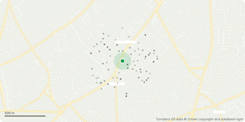
Approximate location - Contains OS data © Crown copyright and database right
Proposal
TPO No. 29, March 1975, Individual Tree: T11 Holm Oak:T1 (T11 Holm Oak):Diameter at Breast Height (DBH): 1.8mTotal tree height: 23mCrown height from ground level: between 3 to 4mCrown spread at each compass point (North, South, East, West): N 12m / S 11m / E 10m / W 5mWorks: Crown reduction by up to 3m in height and lateral spread to bring back from building, contain tree, and balance crown. Reduce crown spread to new dimensions of approximately: Height 21m, N 10m, S 9m, E 8m, W 4m.Additional factors: Decay present within the main stem and primary branches; cavities within structural branches; fruiting body of Ganoderma spp. present; over-extended laterals over high-value targets (buildings, traffic, streetlight); encroachment on buildings and within failure distance of A3. Reduction aims to mitigate lever arm forces and manage risk.Reason: Tree has significant decay and structural issues; works proposed to manage risk, reduce crown loading, and limit encroachment onto nearby structures.
Key dates
- Received 4 May 2025
- Validated 28 May 2025
- Started 28 May 2025
- Decided 4 Jun 2025
Planning history / related applications
No related planning applications have been identified in the current public OGL dataset.
Inside plotEdge
Go beyond the public record
This page is the public OGL record. plotEdge adds the private intelligence layer for this site - open it in the app to unlock:
- Ownership & title Registered owner and title from HM Land Registry.
- Viability & build potential Site scoring and development upside.
- Constraints Flood risk, green belt, conservation areas and designations.
- Approval signal Planning risk and approval-likelihood analysis.
- Comparable applications Decisions on similar nearby sites, side by side.
- Status alerts Get notified the moment this application changes.
Source: public planning application data from Lambeth, reused under the Open Government Licence v3.0. View the council source record. Council documents and drawings are not republished on plotEdge.