Islington
Islington/P2026/0573/TRE
35 Wedmore Street, London, N19 4RU
- Reference
- Islington/P2026/0573/TRE
- Authority
- Islington
- Application type
- Tree Works Notification in Conservation Area
- Address
- 35 Wedmore Street, London, N19 4RU
- Postcode
- N19 4RU
- Status
- FINAL DECISION
- Decision
- Tree Works - Auto Permit
- Received
- 2 Mar 2026
- Validated
- 5 Mar 2026
- Started
- 5 Mar 2026
- Decided
- 13 Mar 2026
- Source council
- Islington
- Council source record
- View public record
- Public data licence
- Open Government Licence v3.0
- Record updated
- 14 Jul 2026
- SEO index generated
- 24 Jul 2026
Location
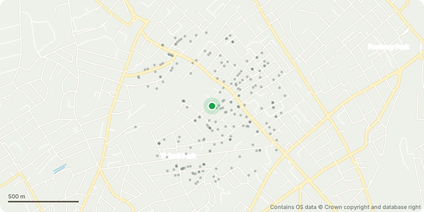
Approximate location - Contains OS data © Crown copyright and database right
Proposal
Tree Species: Cherry (Prunus spp.) Location: Rear garden of 35 Wedmore Street, adjacent to the boundary with Ivo Place (see attached photographs and plan). Proposed Works Full removal of the tree and stump Reason for Work The tree is exhibiting signs of physiological decline and structural concern: Extensive crown dieback was observed in early September, with foliage retained only in one sector of the crown. A Ganoderma spp. fruiting body is present at the base of the trunk and remains visible at the time of writing. There is a basal cavity with visible internal decay and loss of structural wood. Organic matter has accumulated within this cavity. There has been recent shedding of small diameter dead branches (approximately 25mm), consistent with crown decline. Two qualified arboricultural contractors have independently advised that, given the presence of basal decay and overall decline, removal is the most appropriate course of action. Given the tree’s proximity to neighbouring properties and garden areas, the works are proposed on precautionary health and safety grounds. Supporting Information Photographs of the Ganoderma fruiting body Photographs showing crown dieback Photographs of the basal cavity Simple plan showing tree position
Key dates
- Received 2 Mar 2026
- Validated 5 Mar 2026
- Started 5 Mar 2026
- Decided 13 Mar 2026
Planning history / related applications
No related planning applications have been identified in the current public OGL dataset.
Inside plotEdge
Go beyond the public record
This page is the public OGL record. plotEdge adds the private intelligence layer for this site - open it in the app to unlock:
- Ownership & title Registered owner and title from HM Land Registry.
- Viability & build potential Site scoring and development upside.
- Constraints Flood risk, green belt, conservation areas and designations.
- Approval signal Planning risk and approval-likelihood analysis.
- Comparable applications Decisions on similar nearby sites, side by side.
- Status alerts Get notified the moment this application changes.
Source: public planning application data from Islington, reused under the Open Government Licence v3.0. View the council source record. Council documents and drawings are not republished on plotEdge.