Islington
Islington/P2026/0144/S73
Elthorne Estate: Sunken Play Pitch between St, Johns way and Duncombe Road (Site 1);, St John's Community Centre, Holland walk, and adjacent caretakers lodge, Nicholay Road (site 2):, Zoffany Park (site 3), Holland Walk, London, N19
- Reference
- Islington/P2026/0144/S73
- Authority
- Islington
- Application type
- Removal/Variation of Condition (Section 73)
- Address
- Elthorne Estate: Sunken Play Pitch between St, Johns way and Duncombe Road (Site 1);, St John's Community Centre, Holland walk, and adjacent caretakers lodge, Nicholay Road (site 2):, Zoffany Park (site 3), Holland Walk, London, N19
- Postcode
- N19
- Status
- FINAL DECISION
- Decision
- Approve with conditions and legal agreement
- Received
- 19 Jan 2026
- Validated
- 25 Feb 2026
- Started
- 25 Feb 2026
- Decided
- 10 Jul 2026
- Source council
- Islington
- Council source record
- View public record
- Public data licence
- Open Government Licence v3.0
- Record updated
- 14 Jul 2026
- SEO index generated
- 24 Jul 2026
Location
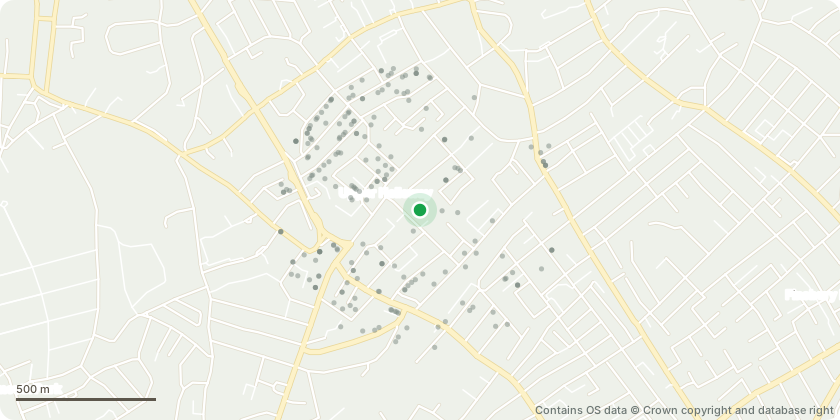
Approximate location - Contains OS data © Crown copyright and database right
Proposal
Section 73 application for the variation of condition 2 (approved plans) of planning permission ref: P2018/2269/FUL dated 30 April 2019 (and subsequent amendments P2020/0941/S73 dated 18 February 2022, P2019/2083/NMA, and P2026/0143/NMA) for: The demolition of the sunken play pitch (site 1), community centre and adjacent caretaker's lodge (site 2) and the construction of a new community centre [282.42 sqm GIA] (site 2) and 46 new dwellings (private and affordable) in four blocks (sites 1 and 2) ranging in height from two to six storeys and associated amenity space, bicycle parking spaces and improvements to the public realm (including to Zoffany Park, site 3). Additionally, stopping up of an area of existing highway to the north and west of Duncombe Road and land immediately west of 158-178 St Johns Way under Section 247 of the Planning Act 1990 to enable redevelopment of Site 1. The amendments include a change to the approved plans to reflect a change to the tenure of dwellings within the development to 100% affordable following the approval of P2026/0143/NMA.
Key dates
- Received 19 Jan 2026
- Validated 25 Feb 2026
- Started 25 Feb 2026
- Decided 10 Jul 2026
Planning history / related applications
No related planning applications have been identified in the current public OGL dataset.
Inside plotEdge
Go beyond the public record
This page is the public OGL record. plotEdge adds the private intelligence layer for this site - open it in the app to unlock:
- Ownership & title Registered owner and title from HM Land Registry.
- Viability & build potential Site scoring and development upside.
- Constraints Flood risk, green belt, conservation areas and designations.
- Approval signal Planning risk and approval-likelihood analysis.
- Comparable applications Decisions on similar nearby sites, side by side.
- Status alerts Get notified the moment this application changes.
Source: public planning application data from Islington, reused under the Open Government Licence v3.0. View the council source record. Council documents and drawings are not republished on plotEdge.