Camden
Camden/2026/1677/T
ZSL London Zoo Regent's Park London NW1 4RY
- Reference
- Camden/2026/1677/T
- Authority
- Camden
- Application type
- Notification of Intended Works to Tree(s) in a Conservation Area
- Address
- ZSL London Zoo Regent's Park London NW1 4RY
- Postcode
- NW1 4RY
- Status
- Final Decision
- Received
- 27 Apr 2026
- Started
- 27 Apr 2026
- Decided
- 1 Jun 2026
- Source council
- Camden
- Council source record
- View public record
- Public data licence
- Open Government Licence v3.0
- Record updated
- 18 Jul 2026
- SEO index generated
- 24 Jul 2026
Location
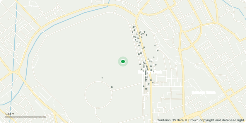
Mapped from public planning coordinates - Contains OS data © Crown copyright and database right
Proposal
CAR PARK PUMP STATION: 1 x Apple (Malus sp) (LZ00703) - Remove basal reversion growth, lift lower branches to approx. 1m and prune tree to 'goblet' shape. 1 x Cockspur Thorn (Crataegus prunifolia) (LZ00704) - Remove basal reversion growth. Crown lift to approx. 1.5m. 1 x American Elm (Ulmus americana) (LZ000706) - Crown lift to 2.5m. 1 x Cockspur Thorn (Crataegus prunifolia) (LZ03329) - Remove reversion growth from base of tree. Crown lift to 2.5m. 1 x Cockspur Thorn (Crataegus prunifolia) (LZ03331) - Crown lift to 2.5m. Remove small lower branches to create clear standard stem. CAR PARK OUTER CIRCLE: 1 x Hybrid Black Poplar (Populus x canadensis) (LZ02055) - Reduce to previous points and remove all other regrowth across crown structure. 1 x London Plane (Platanus x hispanica) (LZ02065) - Reduce all branch structure outboard of stated kink by 2.5m. 1 x Red Haw (Crataegus mollis) (LZ03592) - Remove epicormics base/trunk. CAR PARK PRINCE ALBERT ROAD: 1 x Tulip Tree (Liriodendron tulipifera) (LZ01223) - Crown lift to 3m. 1 x Caucasian Wingnut (Pterocarya fraxinifolia) (LZ01224) - Crown lift to 2.5m - smaller diameter stems only, not main scaffold.
Key dates
- Received 27 Apr 2026
- Started 27 Apr 2026
- Decided 1 Jun 2026
Planning history / related applications
No related planning applications have been identified in the current public OGL dataset.
Inside plotEdge
Go beyond the public record
This page is the public OGL record. plotEdge adds the private intelligence layer for this site - open it in the app to unlock:
- Ownership & title Registered owner and title from HM Land Registry.
- Viability & build potential Site scoring and development upside.
- Constraints Flood risk, green belt, conservation areas and designations.
- Approval signal Planning risk and approval-likelihood analysis.
- Comparable applications Decisions on similar nearby sites, side by side.
- Status alerts Get notified the moment this application changes.
Source: public planning application data from Camden, reused under the Open Government Licence v3.0. View the council source record. Council documents and drawings are not republished on plotEdge.