Brent
Brent/25/1425
Ark Franklin Primary Academy, Harvist Road, London, NW6 6HJ
- Reference
- Brent/25/1425
- Authority
- Brent
- Address
- Ark Franklin Primary Academy, Harvist Road, London, NW6 6HJ
- Postcode
- NW6 6HJ
- Status
- Decided
- Decision
- Permission Granted
- Received
- 14 May 2025
- Validated
- 14 May 2025
- Started
- 14 May 2025
- Decided
- 27 Jun 2025
- Source council
- Brent
- Council source record
- View public record
- Public data licence
- Open Government Licence v3.0
- Record updated
- 18 Jul 2026
- SEO index generated
- 24 Jul 2026
Location
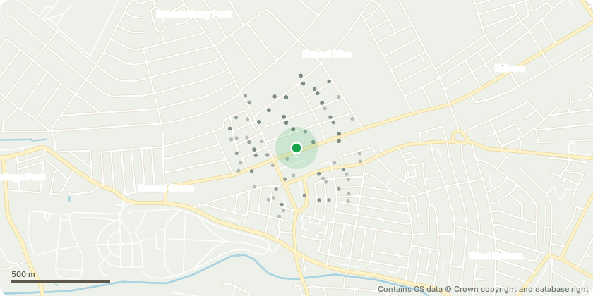
Approximate location - Contains OS data © Crown copyright and database right
Proposal
T1 Wild Cherry - remove lowest SW limb with decay at 3m. T5 Golden Rain Tree - remove minor deadwood T10 Sycamore - crown lift to statutory height of 5.5m T12 Laurel - reduce canopy by 3m in height and 2m in lateral spread G3 Wild Cherry group - install bracing system in codominant stemmed trees (x2) T27 Ash reduce lowest limb growing south over courts by 3m to balance. T29 Wild Cherry - remove lowest branch growing over road. T30 Robinia - reduce back to previous points of reduction.(up to 2.5m); remove lowest limb; prune away from light to give 1m clearance. T32 Wild Cherry - Remove south stem to eliminate potential hazard. T34 Apple - fell to ground level. T35 London Plane - inspect for Massaria platani; prune away from light to give 1m clearance T37 Ash-leaved Maple - reduce canopy by 30% to retard root activity.(approx. 2-2.5m) T38 Plum - reduce canopy by 30% to retard root activity and ensure stability. (approx. 2-2.5m) T39 Ash-leaved Maple - reduce canopy by 30% to retard root activity. (approx.2m) T40 Lawson Cypress - prune back from building to give 1m clearance. T41 Norway Maple - reduce canopy by 30% to retard root activity. (approx. 2-2.5m) T42 London Plane - inspect for Massaria platani; crown lift by 4m all round
Key dates
- Received 14 May 2025
- Validated 14 May 2025
- Started 14 May 2025
- Decided 27 Jun 2025
Planning history / related applications
No related planning applications have been identified in the current public OGL dataset.
Inside plotEdge
Go beyond the public record
This page is the public OGL record. plotEdge adds the private intelligence layer for this site - open it in the app to unlock:
- Ownership & title Registered owner and title from HM Land Registry.
- Viability & build potential Site scoring and development upside.
- Constraints Flood risk, green belt, conservation areas and designations.
- Approval signal Planning risk and approval-likelihood analysis.
- Comparable applications Decisions on similar nearby sites, side by side.
- Status alerts Get notified the moment this application changes.
Source: public planning application data from Brent, reused under the Open Government Licence v3.0. View the council source record. Council documents and drawings are not republished on plotEdge.