Bournemouth, Christchurch and Poole
Bournemouth, Christchurch and Poole/P/26/02828/TCA
The Quomps Christchurch Quay BH23 1BZ
- Reference
- Bournemouth, Christchurch and Poole/P/26/02828/TCA
- Authority
- Bournemouth, Christchurch and Poole
- Application type
- Tree work in a Conservation Area
- Address
- The Quomps Christchurch Quay BH23 1BZ
- Postcode
- BH23 1BZ
- Status
- Application Under Consideration Skip to tab content. Make comments on this application Track this application × To subscribe and follow this planning application please provide us with your full name and email address. Name Email Subscribe Cancel Planning online
- Received
- 17 Jun 2026
- Started
- 17 Jun 2026
- Source council
- Bournemouth, Christchurch and Poole
- Council source record
- View public record
- Public data licence
- Open Government Licence v3.0
- Record updated
- 18 Jul 2026
- SEO index generated
- 24 Jul 2026
Location
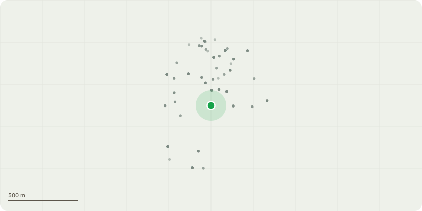
Approximate location
Proposal
T269 Populus x candicans (Weeping poplar) - Aerial Surveys/Climbing Inspections - Inspect upper north limb at historic failure point for decay; reduce or remove if necessary & Remove major deadwood as much as reasonably possible invcluding small hanging branches - T271 Salix x chrysocoma (Weeping willow) - Remove major deadwood & Reduce heavy branch weight by - Reduce heavy branch weight on the central primary leader with hazard beam by approximately 3m. Lightly reduce the adjacent co dominant leader to match height. Reduce the lateral leader on the north side, with crossing branch, by approximately 2m. - T273 Salix x chrysocoma (Weeping willow) - Fell to ground level - - T277 Prunus species (Cherry) - Fell to ground level - T281 Salix x chrysocoma (Weeping willow) - Remove major deadwood - T282 Platanus x hispanica (London plane) - Aerial Surveys/Climbing Inspections - Carry out an aerial inspection of the upper branch structure to determine whether Massaria disease is present on scaffold limbs and to assess any associated decay or dieback. · Remove major deadwood - T289 Alnus cordata (Italian Alder) - Fell to ground level - T291 Platanus x hispanica (London plane) - Aerial Surveys/Climbing Inspections - Carry out an aerial inspection of the upper branch structure to determine whether Massaria disease is present on scaffold limbs and to assess any associated decay or dieback. · Prune to clear lamp column - by 0.5m · Remove major deadwood · Reduce heavy branch weight by - low primary limb to south with jelly ear, reduce by 1.5m - T292 Platanus x hispanica (London plane) - Aerial Surveys/Climbing Inspections - Carry out an aerial inspection of the upper branch structure to determine whether Massaria disease is present on scaffold limbs and to assess any associated decay or dieback. · Crown lift to 2.3 m over Footpath · Remove major deadwood
Key dates
- Received 17 Jun 2026
- Started 17 Jun 2026
Planning history / related applications
No related planning applications have been identified in the current public OGL dataset.
Inside plotEdge
Go beyond the public record
This page is the public OGL record. plotEdge adds the private intelligence layer for this site - open it in the app to unlock:
- Ownership & title Registered owner and title from HM Land Registry.
- Viability & build potential Site scoring and development upside.
- Constraints Flood risk, green belt, conservation areas and designations.
- Approval signal Planning risk and approval-likelihood analysis.
- Comparable applications Decisions on similar nearby sites, side by side.
- Status alerts Get notified the moment this application changes.
Source: public planning application data from Bournemouth, Christchurch and Poole, reused under the Open Government Licence v3.0. View the council source record. Council documents and drawings are not republished on plotEdge.